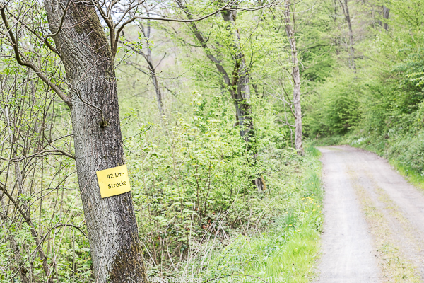
If you don’t believe that, you didn’t participate in the hiking marathon last Saturday in Steinbach. From kilometer 30 on, the challenge was to “climb” the Donnersberg – for me at that moment the highest mountain in the world!
Hiking Marathon? Let’s go!
And how did I even get the idea to participate in a hiking marathon?
I’ve jogged and run half marathons several times – it’s always been great fun. When I stumbled upon the information about the hiking marathon a few weeks ago, I couldn’t get this idea out of my head.
Luckily, a at place registration was possible, the Donnersberg is practically on the doorstep of Rheinhessen (so it’s not a long journey) and the weather forecast seemed perfect – the adventure could begin! Never before in my life I have walked 42 kilometers in one piece – but – trying is studying.
So the alarm clock rang on 06. May at 05:30 and after an extensive breakfast I set off for Steinbach.
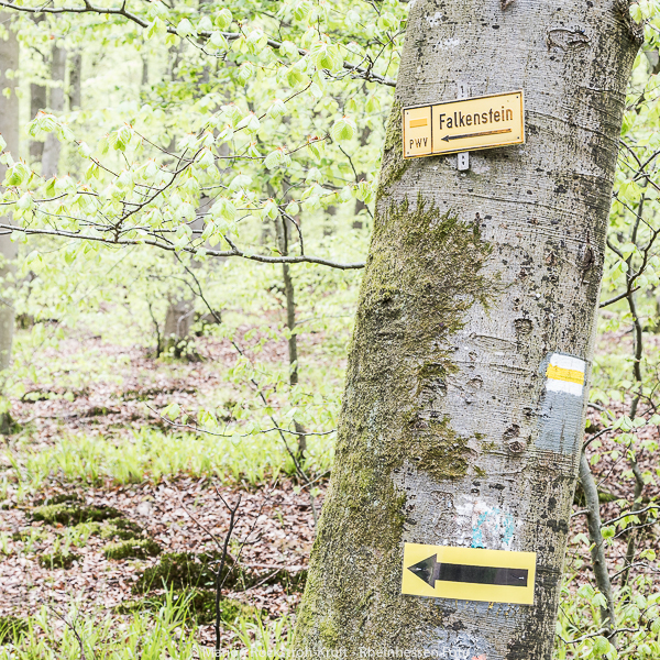
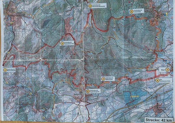
The Donnersberg Touristik, together with the Palatinate Forest Clubs Imsbach, Steinbach, Dannenfels and Rockenhausen were responsible for the organisation – a big praise for this – even I didn’t manage to get lost!
… twice I hesitated, but fortunately friendly and helpful fellow hikers “caught” me again and again.
Hiking Marathon – Stage 1
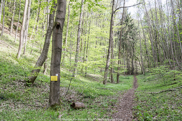
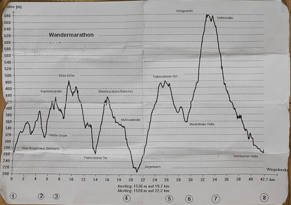
Equipped with a few vitamins, provided by Obsthof Enders, my stamp card, the altitude profile (I better didn’t look at it at all) and a map extract I set off in beautiful weather.
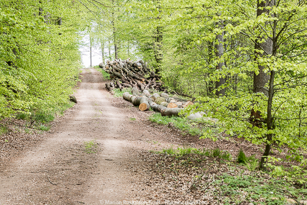
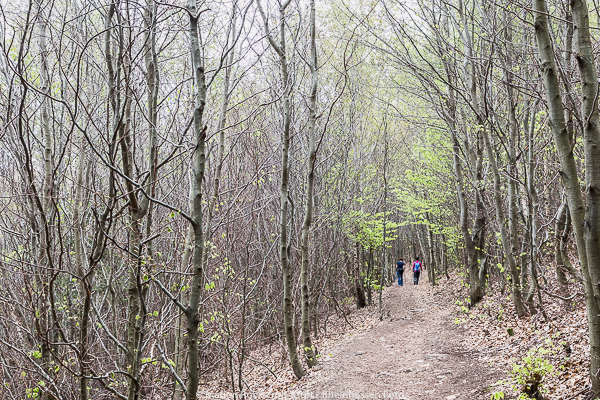
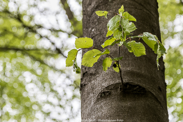
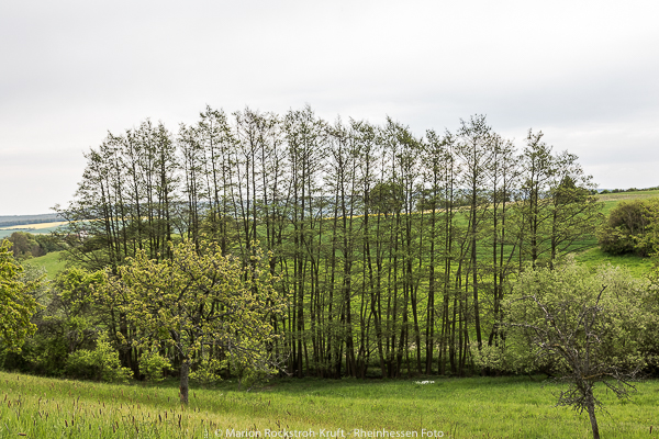
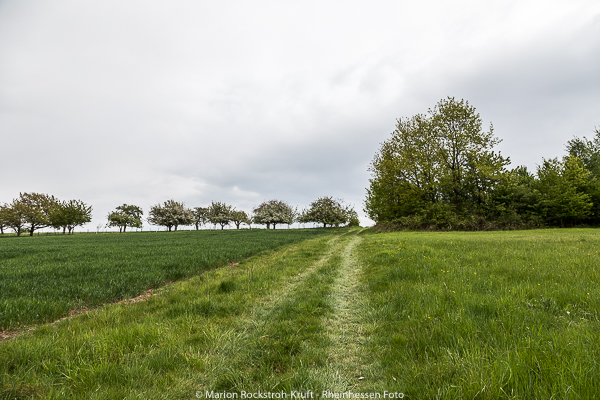
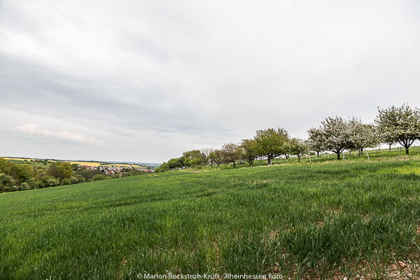
The path only led through the village for a short time, and then quickly led across meadows and with wonderful views directly into the forest.


Hiking Marathon – Stage 2
After about five kilometres there was already the first stamping point at the “Weisse Grube Imsbach”. Well well – warmed up I was already there 😉
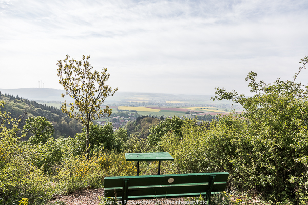
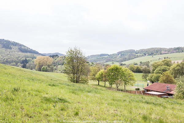
Further through the woods – uphill – I soon reached the next stamping station “Kupferberghütte” – what a wonderful view was waiting for us here!


Hiking Marathon – Stage 3 “Dicke Eiche”
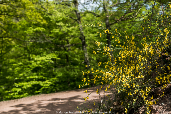
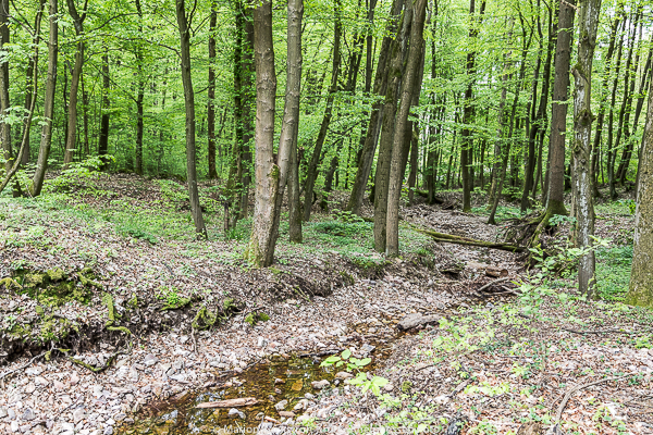
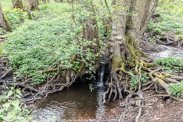
The next destination was the “Dicke Eiche” (thick oak tree) – I only felt that it was uphill until there, which of course was not true when I looked at the altitude profile. The path was very varied – again and again there were wonderful views and narrow paths led through the fresh green of the Palatinate Forest.
From there the path continued into the Falkenbergertal – the downhill walk was very pleasant, but the description already mentioned something about Falkenstein Castle. I had the feeling that soon it would be uphill again 😉


Hiking Marathon – Stage 4 “Falkensteiner Hof”
At the stamping station “Falkensteiner Hof ” (approx. 25 km) some people took a break, but since I stopped again and again for photos, I did not want to dawdle too much and continued my way directly towards “Blockhütte Marienthal”.
On the way there, I slowly felt some discomfort in my feet – I thought I might have wrinkles in my socks …
So a little check – no – in any case it did not feel good … I generously declined the benevolent offer of a fellow hiker to help me further with blister packs – which I would have liked to have cancelled later and still regret today!


Hiking Marathon – Stage 5 – uphill to Donnersberg
Unfortunately, my feet didn’t mean well with me and every movement hurt – from step to step more. Anyway – I could not change it now – so further and further uphill.
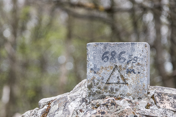
Well – and here exactly I realized – the highest mountain in the world on 06.05.2017 is the Donnersberg.
Actually, the way led up on picturesque narrow paths – but I could not really enjoy this part of the way.
Finally reaching the top, the view reconciled a little bit, especially the knowledge that it would now mainly go downhill. 🙂
At the stamping station “Keltenhütte” I didn’t care if I would lose time or not – the non-alcoholic wheat beer had to be and was able to awaken new spirits in me!


Hiking Marathon – Stage 5 – only downhill from now on
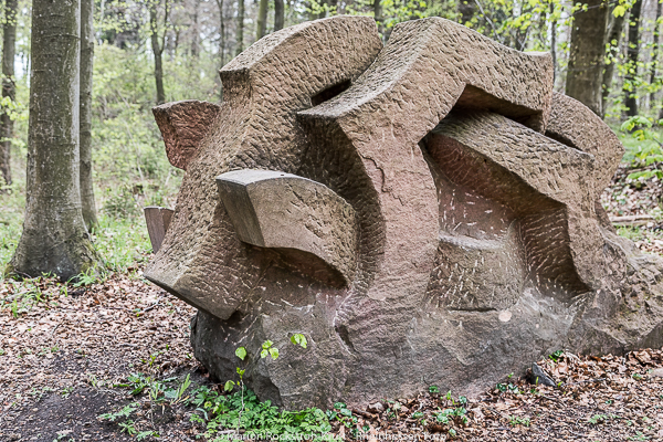
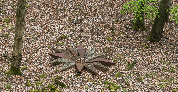
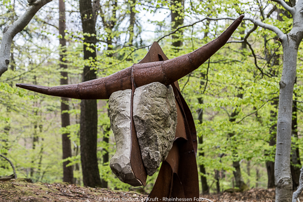
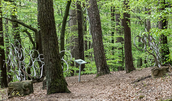
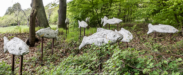
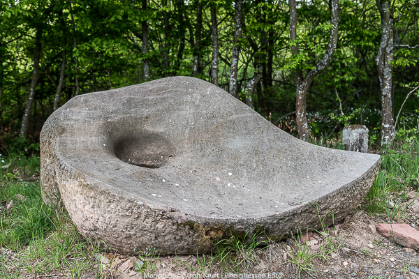
The last seven kilometres now stretched painfully downhill and were fortunately wonderfully loosened up by the Celtic sculpture path. There were always new and different artefacts to discover.
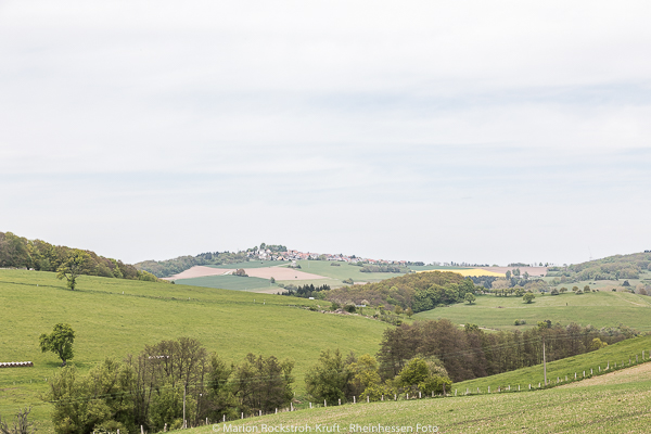
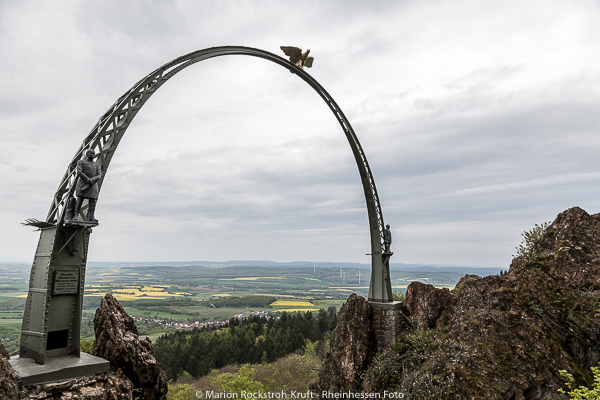
I perceived the Eagle’s Arch quite impressive, combined with the wonderful view – the rapeseed fields formed picturesque splashes of colour in the landscape.


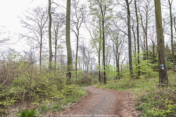


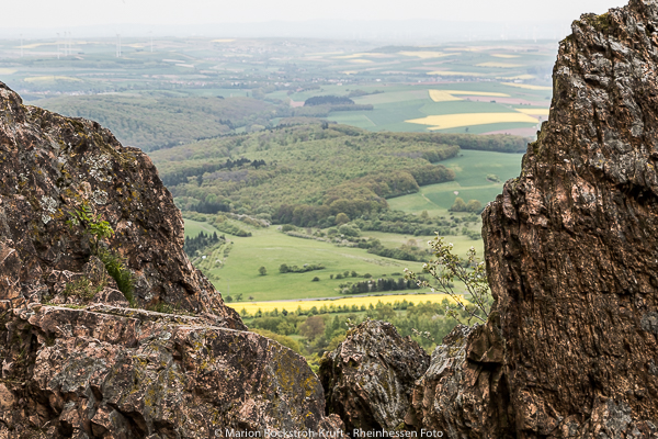

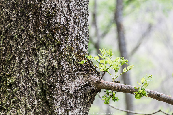
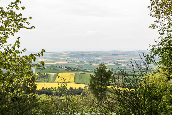
Wide parts of the forest were glowing because of the fresh leaf sprouting – no – I didn’t turn the saturation too high in the pictures – the colours sometimes seemed almost unreal!


Since I tracked the whole route on my Runtastic app, I was always friendly informed by the nice lady how many kilometres I had already covered. As we slowly arrived in the 40s region, I became more and more exhilarated and was happy that I had survived all this in such a great and good mood.
But when the nice voice arrived at kilometer 44, I slowly realized that the app got stuck again and that the end was not so close after all …
In the end it wasn’t that bad, there were still about four kilometers to go, as a nice fellow hiker showed me on his GPS device, but I was out of breath.
On the last kilometer I had to “climb a hill” again – but the view of Steinbach, to the left, revealed that the end was now within reach.
Hiking Marathon – Stage 6 – this is the end!
In the Steinbach-Hütte I happily received the last stamp and my certificate. I had made it – against all odds!
The members of the PWV had gone through so much trouble, there was music and delicious food, it smelled wonderful – but all I wanted to do was to go home – take a shower, put my feet up and let my husband cook for me (which he kindly actually did)!


Conclusion
Now, if you’re wondering, who actually does this?
Well, I have to tell you, I was in very good company:
317 hikers,
from 14/15 to 70/80 years were on the road.
175 participants chose the 21-kilometer route,
60 participants marched the 30 kilometer round,
and 182 participants mastered the 42 kilometer long hiking marathon
To all of you at this point as well: Congratulations!
… and for the next time – yes there will hopefully be one:
- well-intentioned help I won’t turn down any more
- a GPS is helpful if you want to keep track of things
- to start in a group, certainly gives even more pleasure
- Do not enter the start line until you actually start walking 😉
- Wrap up blister plasters and use them as a precaution, because no one needs blisters like these that I have run into …
- I would like to take this opportunity to thank the great organisation and all the volunteers, because without them such an event would not be possible.
THANK YOU!
But I still have a small suggestion for improvement.
It would have been nice to be able to buy still water. Also the medium sparkling had too much bubbles and drinking from the drinking tube was quite unpleasant.
…
Oh yes – and when was the date again for next year?
🙂